Map GR 10 Andorra
 |
1
 |
2
 |
3
 |
4
 |
|
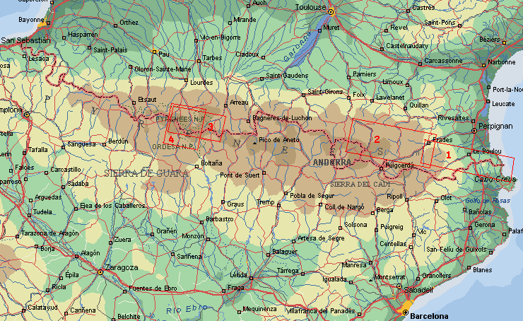
Pyrenees Hike 2
Continuing the GR 10 in the east, partly the High Route Pyrenees. Including Pic Carlit
and Andorra.
|
On Col de Jou we continued the GR 10 from Hike 1, on this lovely natural trail
with only a few walkers in this area. This part is higher, so there are
less trees, but many many flowers in stead.
Along the high ridge for 3 days, beautiful views again and small villages like
Mantet. Then descending to Mont Louis. The most exciting part was the Carlit-area
with lots of lakes, little and very big ones. On the top (2.921 m) we had
a panoramic view, from the Canigou to de pic d'Aneto. Climbing and descending
the steep top with heavy backpacks is something to be prepared.
Via some nice passes we came in Andorra, many tax-free shops. We enjoyed only
the landscape of northern part. At the border panoramic views again. Then
a long descent to the Vallée de Ariège, and back in the crowded world.
Practical route information
By train to Villefrance-le-Conflent, by bus to Vernet-les-Bains (start walk) > Col
de Jou (Grande Randonnée 10) > Col Mitja > Mont Louis > Pic Carlit
> Mérens-les-Vals (H.R.P.) > Col Pic de Ruf > Val d'Incles Andorra
> Porteilles de Fontargente > Les Cabanes. By train to Foix.
Length 123 km, average height 1.990 m, 10 hiking days.
More huts then walk 1, but mostly we slept in the tent.
Copyright ©1998/2001 Jaap van der Veen
|
|
|


