|
|||||||||
|
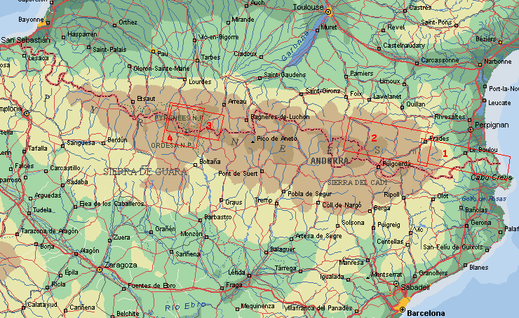
Pyrenees SurveyIntroductionThe mountain range of the Pyrenees stretching for 435 km between the Atlantic and the Mediterranean acts as a great nutural frontier dividing Western Europe from the Iberian Peninsular. The range is one of contrasts. On the northern slopes the mountains fall steeply to the planes, while the Spanish side is confused by series of successive ridges which run in a maze away from the main crest. The range is 60 - 130 km wide. In the west the hills of the Basque country recieve the heavy, moisture-laden winds from the Atlantic. The eastern sector has a truly Mediterranean climate with low rainfall and very hot summers. The north side is more green of the vegetation because of the rain in comparision with the south. About 200 km of the range is above the 2.000 m, mostly below the 3.000 m. Scenically the Pyrenean landscape is rich and varied. The oak and pine forest of the west are far from the scorche plateaux of Catalonia where vineyards and orchards dress the valleys. Between these extreme the Hihg Pyrenees contain all the atractions of alpine scenery; sharp, irregular peaks splashed with snow, deep trench-like canyons, great amphitheatres (cirques), and many hundreds of glistening mountains tarns. Here are almost ninety mountains above 3.000 m. The highest are the Pic de Aneto (3404 m), de Pic Poseto (3371 m) en de Monte Perdido (3355 m). There are several natural reservates: Parc National de Pyrénées and Parc de Néouvielle on the French side ande National Park de Ordesa e Monte Perdido and Parc Nacional Aïgues Tortes in Spain. But also outside these is a beautiful flora and fauna. For instance many chamois and birds of prey like Griffon and Bearded vultures. The bear is almost disappeared, only a few survived until now. The parks are the highlights, but also the most busy. The eastern and western areas are more quiet and very nice to hike too. Long distance trails
Hikes on this website
Route information
Updated 2009 January 2th Copyright © Jaap van der Veen |
||||||||
|
|
|||||||||


